The Beginning of the Proving Ground
|
Home Shawnee Pioneer World War II Korea Vietnam Gulf War National Wildlife Refuge JPG Heritage Partnership
| The 1940s:Although in 1940; 75% of the land belonged to ancestral homes, 25% were tenant farmers, some of whom went broke and moved out of the area prior to the establishment of JPG. Plat maps of the area in the 1920s, 1930s and 1940s indicate that banks and insurance companies owned a substantial number of farms in the JPG lands. At the time the ammunition test center was built there were 2,000 people living, loving, and subsisting on this land. Interviews with former residents indicate that while life was hard, by todays standards, entertainment was negligible, the people banded together to weave a fabric of schools, churches, roads, dams, bridges, and homes that made life, if somewhat spartan, certainly enjoyable and fruitful. Several residents have jokingly stated that they did not know they were poor until they moved from the area. In the 1930s, the War Department started looking for land to be used as an artillery and bombing range, east of the Mississippi. Forces of nature had provided attributes that accounted for the selection of southeastern Indiana as the logical location to test bombs. Indiana was the "Crossroads of America". The state was centrally located: one third of the population and 80% of the manufacturing plants in the United States were within 350 miles, yet the area was isolated. A low population density, flat ground, inexpensive land, and patriotic people made the place Ideal to test instruments of war. Instruments that very soon would be applied against Japan, Germany, and Italy after Pearl Harbor was attacked on December 7, 1941. By the time of the attack, the U. S. Government had transformed communities consisting of 2,000 people, 3,500 graves, 8 churches, 5 schools, a few businesses, and 500 farms into a high technology High volume munitions testing ground. 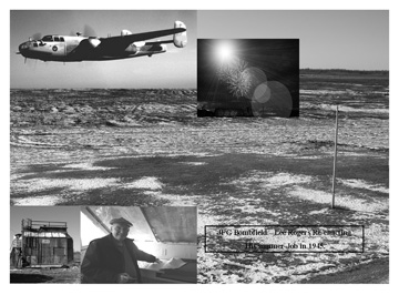
The Bomb Field in 1944 where Lee Rogers worked summers at JPG. His job was to punch the timers to measure the time of illumination of flares dropped by the plane. 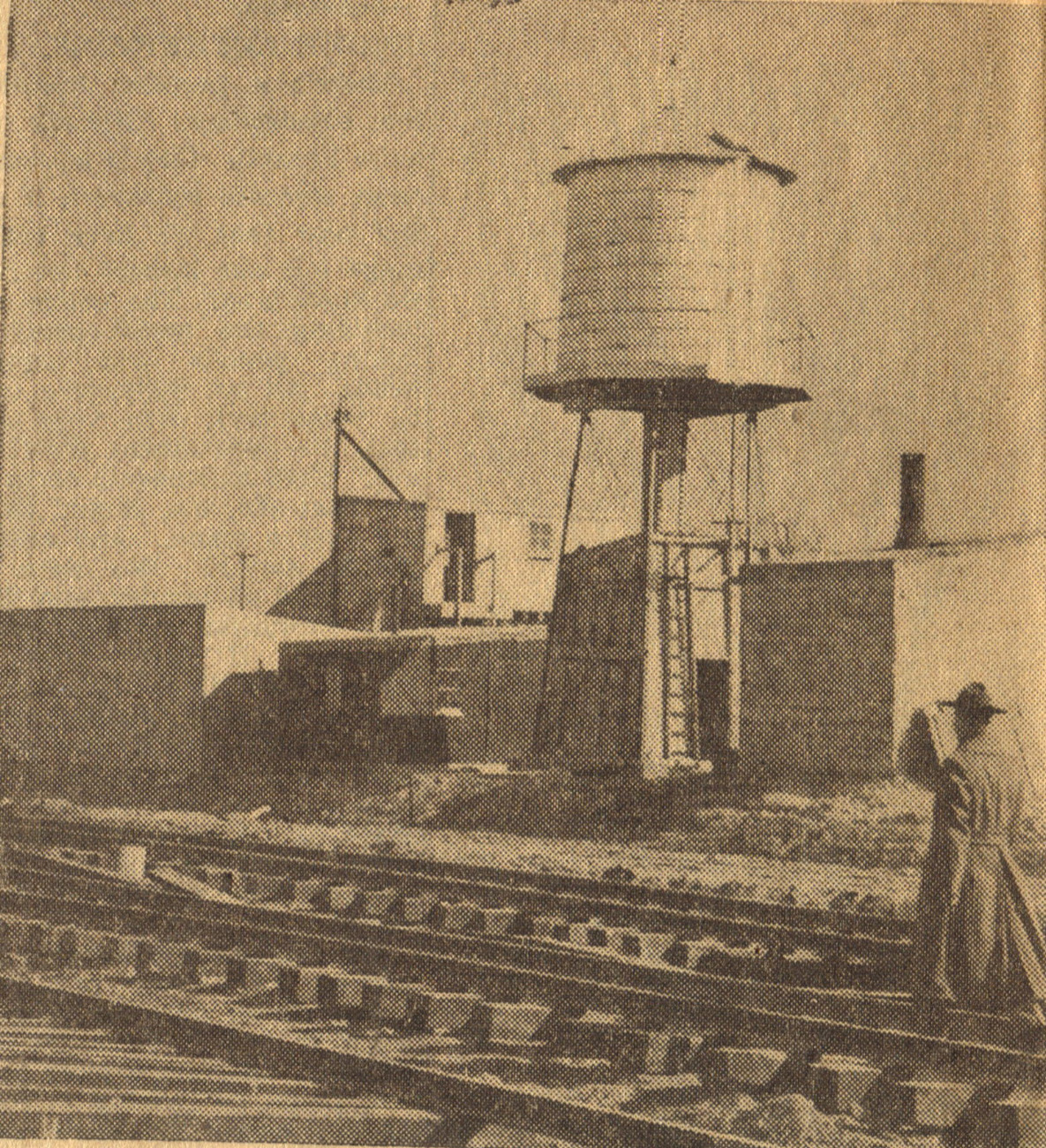
17 miles of railroad track were laid for the incoming ammunition. Betty Cull was an aerial observer at the Bomb Field during the war. The land made flat by a glacier a million years ago was perfectly situated to create an artillery and bombing range. By December of 1940, fourth generation Hoosiers were saying their good-bys to neighbors, friends and relatives. Farms that were once home and anchor to the people were sold to the government. Cemeteries with graves of the original settlers, backwoodsmen, soldiers, statesmen, farmers and teachers who had earned their eternal reward were re-interred to new ground outside the bombing area. One year later, December of 1941 the transformation was complete. Until the present time, public access has been denied to the 55,264 acres. As though the deafening thunder of the cannos and the weekend sorties of Air National Guard attack bombers are not reminders enough for the public to keep out, signs are placed along a barbed wire and chain link fence in orderly increments of distance along the entire 48.9 mile JPG perimeter to serve as visual reminders to keep out. Mr. Howard Green, a long time employee of Jefferson Ground from Cross Plains, recounted that as a young man he helped dig the holes and string the wire mesh that served as a security fence. Mr. Green stated that Lodge Hardware of Madison had the contract to deliver the material to the work site. Howard told that the holes were dug by hand, but in some areas, shallow ledges of bedrock were encountered that required some Hoosier ingenuity to penetrate. Mr. Greene's eyes would light up and a slight smile would creep across his face as he related that a stick of dynamite has to be used to supplement the shovel and pick ax. Of course they had to wait until the supervisors were not around. Perimeter of JPGIt is difficult to describe the size of the land mass and the enormity of the task involved in the conversion of quiet rural communities and farms to a military reservation. Perhaps if we could take an imaginary trip around the boundary line, this mass migration can be comprehended. The single most visible portion of the proving ground that the public can see is the fence. As viewed from an automobile speeding north on Highway 421, this fence appears as a silver serpentine ribbon running through Jefferson County parallel to the great Michigan Road on the East, on into Ripley County, then jutting westward keeping its distance from Highway 50 until reaching Jennings County where it makes a square left turn just south of a village called Nebraska. Slicing a sliver of land from Jennings County, we return our imaginry vehicle south to Jefferson County intersecting the Madison Railroad that serves as the southwestern boundary for the proving ground. At the location called the "old wirt Station", we steer our craft due east along County Road 500 North; finally intersecting with Highway 421, Our point of origin. 
Construction Begins:Land acquisition for JPG began in 1940 and construction began in 1941, with the installation in active use by the end of that year. By 1945, 149 of its 332 buildings had been erected, with maintenance, administrative, test firing and assembly facilities, as well as the airfield built on the south end of the installation and observation bunkers built uprange in the test firing area to the North. (from the "Cultural Resources Plan") Before the construction was complete, the army decided to test fire powder for 75mm guns. The first ceremonial round was fired on May 10. The first powder test was fired on 12 May 1941. according to the Madison Courier of 6 May 1941, construction peaked in May 1941 with 3,105 persons working. In December 1941, the first plane arrived at the JPG Airport. 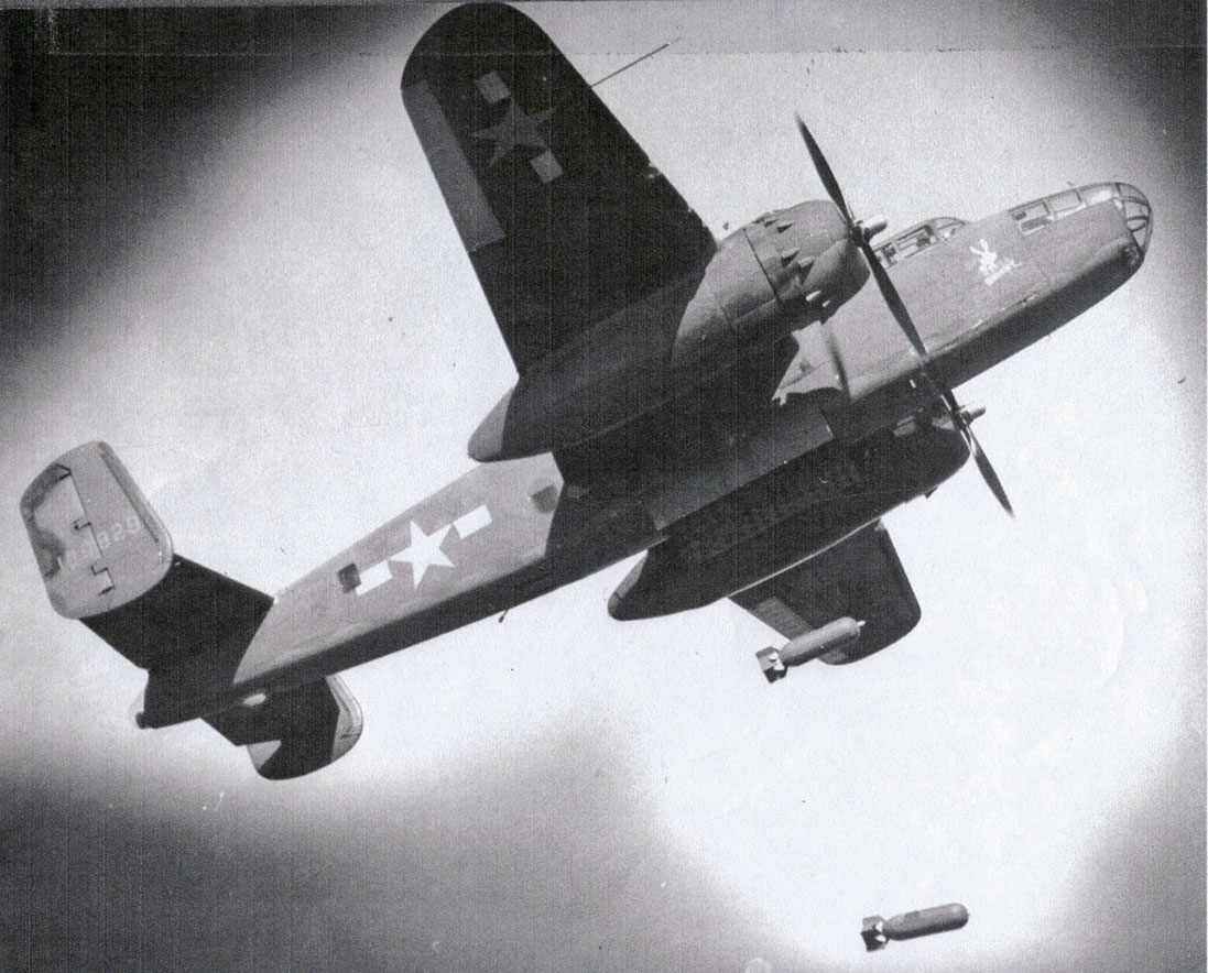
B25 "Mitchell Bomber" Dropping Bombs at the Bombfield in Ripley CountyAfter Pearl Harbor was attacked, the proving ground was expanded in 1942. The peak government workforce was almost 1300 civilian and military employees. JPG's contribution to the war effort was significant. During the war, 7, 423, 657 rounds were tested and reported on. By procuring the ammunition and testing it before any items were distributed for the troops use, the munitions could be stored safely, and would function in the manner for which it was intended. It has been estimated that nearly 35% of the German shells fired at the "Battle of the Bulge" were "Duds" as compared to only 4% fired by the Americans. At War's end, the proving ground was de-activated and its buildings were mothballed, only to be re-activated in 1949, shortly before the outbreak of the Korean War. The workforce was reduced from nearly 1300 to 51. These included 14 Fire-fighters, who also served as guards, 18 maintenance men, 7 supply workers, 1 artillery surveillance man, and 11 general laborers. (from "Cultural Resources Management Plan".) 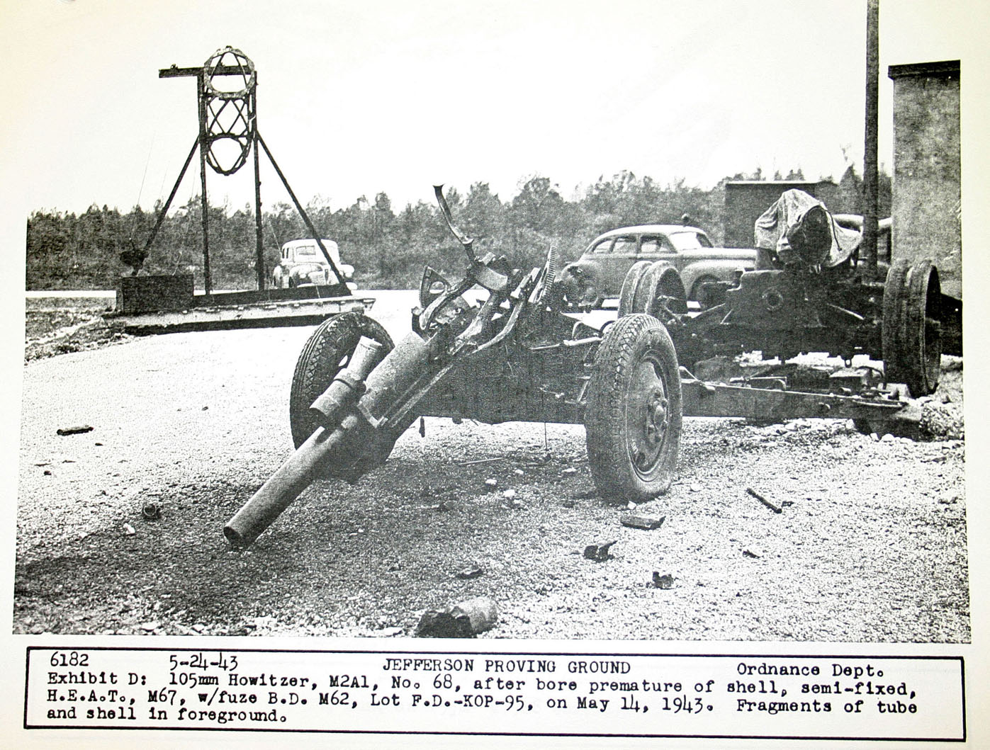
Ocasionally an untested round would explode inside the gun tube. Havoc would ensue. Terrible damage would have been inflicted on Americans or their "Allies" instead of the intended enemy. Home |